Saturday, January 21, 2017

Leh to Pangong Tso - Lake with magical shades of blue.

  
  Pangong is an endorheic lake with crystal clear brackish water in the Himalayas, nestled at an altitude of around 4350 m and is 134 km in length and 5 km in width with a maximum depth of 100 m. Around 60% portion of the lake lies in the Tibet region of China and line of actual control passes through the lake. This Lake changes its color in multi shades of blue with the changing position of the sun in the sky. This lake freezes completely during the winter despite being saline water. Reportedly there is no fish or any aquatic life in the lake, except crustaceans. In the summer period, a significant number of birds can also be seen around the lake including the most common  Bar-headed goose and Brahmini ducks.
  The journey from Leh to Pangong Tso is a 5-hour drive, mostly through rough and uneven terrains and some dramatic mountain roads. Even though its only 160 km from Leh to Pangong Tso, the journey is tame taking. Hence an early start from Leh is recommended. Since Pangong Tso is situated at a higher altitude of 4350m, the lack of oxygen makes survival difficult if your body is not properly acclimatized to its high altitude and hence, one need to plan his/her journey extremely carefully to make it an acute mountain sickness free vacation.
  A Trip to Ladakh is incomplete without a visit to this beautiful Lake. The spectacular lakeside is open during the tourist season, i.e., from May to September. Earlier inner-line permit was required to visit Pangong Tso, which is no longer necessary now.


Route: 

Leh – Shey – Karu – Shakti – Chang La – Durbuk – Tangste – Lukung – Spangmik (Pangong Tso)

Distance: 

160kms (Note: Distance between the places are matched with Google map and has been self-evaluated throughout my own journey)

Transportation:

Motorcycle enthusiasts who are unable to take their bikes to Leh can get one for rent for local sightseeing and to go to places such as Pangong Tso. One can find numerous bike rental shops at Leh. You can also hire a taxi in Leh to visit Pangong Tso. There is also a public bus service from Leh which drops off visitors at the Spangmik village.

The Journey:

Pangong Tso is located roughly 160 km from Leh. Many travelers do the Leh – Pangong Tso excursion as a day trip and come back to Leh by nightfall. However this is not at all recommended since the 320 km long round trip will be a rush as most of the time will be spent in travel and leaves little time for Pangong Tso, which is a magnificent lake and doing this excursion in the span of 2 - 3 days is highly recommended. One should be acclimatized properly by spending a night or two in Leh before attempting to sleep near Pangong Tso.

Leh - Karu (35 km):
  Start early in the morning and driving/riding on the Leh – Manali highway till Karu can be done in an hour. You will cover Thicksey, Hemis, and Shey monasteries while going through this route. The road is in good condition, and the journey is fast-paced.

Karu - Shakti (10 km):
  From Karu, you'll find a diversion to Pangong Tso, and that would take you to the village Shakti. Roads are mostly straight till you cross Shakti.

View of village Shakti

Shakti - Chang La (33 km):
  A few kilometer after Shakti the real ascent for Chang La starts. The ascent is very steep and requires a careful drive. Initially, roads are in good condition, and as you approach the final few km of the ascent to Chang La, road conditions start to deteriorate and steepness increase, making the affair of reaching the summit of Chang La more challenging and memorable.

Of all the passes one encounters in Ladakh (barring Marsimik La), Chang La is the steepest, and due to bad roads at the final ascent it is also the toughest, no wonder it is called "The Mighty Chang La."

Chang La, the name literally means "Pass towards the South." At 5360 m it is claimed to be the second highest motorable road in Ladakh. Once you reach the summit, you will be greeted by the Indian Army troops who are stationed here. There is Chang La Baba ki Mandir built by Indian Army and also a small cafeteria, so take a small photo break and enjoy the beautiful scenery around you.

Chang La - Durbuk (30 km):
  After Chang La, the descent begins, and the road is in bad condition for few kilometers, beyond which superbly laid tarmac coupled with beautiful scenery awaits you. You will find Army base camp in Durbug.

Durbuk - Tangste (8 km): 
  When you reach Tangste, one has to register his name along with vehicle number. Tangste is a small town with few shops and hotels. In case you have arrived late in the evening, then spend the night here instead of continuing to Lukung or Spangmik where finding accommodation in peak season can be an issue.
Tangste - Lukung (34 km):

 Journey beyond Tangste, most part is through fantastically laid tarmac and beautiful valley views. However one should not over speed, as this area is a habitat for Himalayan marmots. And one should drive cautiously as you may see them crossing the roads.


Lukung - Spangmik (Pangong Tso) (10 km): 
  Reaching Lukung, you will get the glimpse of Pangong Tso. As you approach the lake, the sheer size of it starts becoming more apparent as you finally reach its shores. On the banks of the lake is a military camp and also a collection of tents and newly built Eco Huts. You can either choose to stay at the tented accommodation at Lukung or continue to Spangmik.

The small settlement visible from here is the village of Spangmik, the last village up to which you are allowed to go. Beyond Spangmik there are two more villages, Man and Merak but tourists are not allowed beyond Spangmik.

The first glimpse of Pangong Tso

Pangong Tso


Accommodation:

Pangong Tso (Spangmik) mainly has accommodation available in the form of tents, campsites, and some luxury tents, some of them just right on the shore of the Lake. Also, home-stay is available here.

Accommodation in Lukung is available in the form of eco huts just right on the shore of Pangong Tso. Besides this one can also pitch one's own tents here. Facilities like electricity, medical aid, hot water, western toilets, etc. are rare to find.

You can also plan for a stay in Tangste, even though it is 34 km before Pangong Tso, it is a good place to spend the night, due to a sheer number of accommodation options and better quality than Lukung and Spangmik.


Amenities:

Petrol pumps: It is essential to fill up your vehicle's petrol tank at Leh and carry enough petrol for the return journey since there are no petrol pumps beyond the outskirts of Leh.

Phone services: Beyond Thiksey there are no phone booths and mobile phone coverage.


If you found above article useful, please provide your valuable comments and stay connected with us also on FacebookInstagram, and Youtube.

Friday, January 20, 2017

Trek to Kheerganga


  Kheerganga is situated at 2960 m of altitude in Parvati valley of Himachal Pradesh offers a mystical journey into the woods, where you will see a waterfall, river, water crossing, mountains, apple orchards and one of the gifted abode for natural sulphur hot water springs.

  For Kheerganga you need to take a bus or taxi up to Barsheni, crossing Manikaran. Barsheni is the last stop in Parvati Valley, and beyond Barsheni no motorable road is available, and one has to trek to reach to the villages like Pulga, Tosh, Nakthan, Rudranaag, Kalgha, and Kheerganga.  The trail in the entire trek is well defined, and one can hike without any guide. Moreover, you can find many local peoples, other trekkers, and porters who travel up and down carrying vital supplies along with their horses of donkeys from whom you can ask for trail and the distance left.

  At the beginning of this 13 km trek, You will see a massive construction of an Hydel power plant in Phulga.  From where you trek to the very first village Nakthan, which is around 3-4 km (45-60 min), the trail will lead through lush farms, small hills and,  apple orchards, and remember don’t pluck apples from these trees, they may fine you if they caught you.  You can get eatables in Nakthan.

  Trekking to further you will reach Rudranaag (60 min), a small meadow surrounded by mountains where you’ll find a waterfall, Parvati river on the other side, and a Maggie point.

   Just by leaving Rudranag you will cross a wooden bridge built precariously in two wooden logs over Parvati river. And then you will enter the lust green, and thick forest of pine trees and where ascending begins. This entire trail from Rudranaag to Kheerganga is completely into the woods, and you may get some slippery and wet trail as well, so make sure you have a support stick with you.

  On your way to Kheerganga, you will find one more Maggie point named as Sunflower cafe, and you can see some sunflower plantation nearby. And after some three hours of trek, you will reach Kheerganga a beautiful meadow, surrounded by snow covered mountains. And a dip in the hot spring water pool after you reach will soothe and relieve from the worn out you experienced during trekking. Taking a bath in nature’s lap and surrounded by snowy mountains is a delightful and a unique experience. The water is natural, hot and has some healing properties of white sulphur. There is a different and covered area in the pool for ladies seeking their privacy.
Localites from nearby villages of Pulga, Kalga, Nakthan, Tosh & Barsheni have set up shops, eating joints, Inns, and camps here. 
Returning and trekking downwards is much easier and you can cover it up in 3 hours.

  Carry as lightweight as you can. Don’t carry excess water bottles and foodstuff as it’s going to make your trekking difficult. You will get everything on the way and also in Kheerganga. Start your trek maximum by 10.00 am. Carry sunscreen, hat, necessary medicines, torch, Raincoat and a camp light if you wish to stay in a tent.


En route to Kheerganga.. 

As we started our trekking and just after crossing the hydel power plant, we are welcomed by this giant tree. So we are not the only one with good height.😀


After bit tiring we reached Nakthan, houses here are built by arranging wooden logs and stone.


We felt greedy by seeing those apples, but these trees are also tagged with a board with a notice "1000 Rs fine". So we politely asked for apples, and the villagers happily gave us few apples for free.


This kid from Nakthan getting ready for school was so glad to pose for a photograph.


And this lazy bun doesn't bother if you take a snapshot.


A local house in Nakthan. Most of the houses here are built with wooden logs. And natural slates are used for roofing.


Tiny white blossoms.


and the waterfall racing down in a series of cascades.


And then we reached to Rudranaag, where one can see the Rudranag temple and some desolated huts. 


Waterfall nearby the temple.


We rested in the meadows and delighted by the scenic view of the valley at Rudranaag.


Then we crossed this swaying bridge, and the heavy streamflow underneath the bridge shook us a bit.😥😱


Look at the flow of the Parvati River.


That's why they call it as KheerGanga, the flow of water resembles a Kheer (Rice Pudding).  


And then we entered into a thick and dense forest.


and crossed those water streams.


A closer look at the water flows.


On our way, we found a tree with a hollow trunk. This trunk is so big that one can easily fit into it and can hide inside it.😉


And then we met some porter with their Himalayan horses, in a wrong place. Because we got no space to get aside and somehow we managed ourselves by balancing on that rocky slope to avoid any hit from the luggage.


This waterfall on the nearby mountain is remarkable.


Then we reached Sunflower Cafe, somewhere in the middle of the jungle and time for a small break,  where we had some refreshments, and of course, we clicked some photographs of these beautiful sunflowers.


And also took some shot of this eye-catching pine.


The first thing one will notice while reaching the top is this standalone giant tree.


And finally, we arrived at this divine meadows. The moment we arrived here, we are in a big hurry and excited to take a dip in the hot water spring. We relieved ourselves from all the tiredness and then relaxed in a tent house. Had some savoring non-veg food and slept peacefully.


  Next morning, we get ready to return. And was mesmerized by watching the first sun rays hitting the mountain which is so amazing on its own.


This tree once again attracted us.


This Himalayan dog followed us in the entire trail and bade us adieu at Rudranaag.


So the experience was amazing, as this trek brings us close to nature, and definitely relieved us for some days from those hectic lifestyles we were spending in the cities.

Sunday, January 15, 2017

Trek to Malana


  Malana is a small ancient village and is famous for the world's best Hashish: "Malana Cream." Malana is situated at 2652 m above sea level, and this community is considered as one of the oldest democracies in the world. Malana is more of a village for backpackers and travelers and less for tourists.


There are various myths regarding the origin of the people, and they remained a secluded society for a long time without paying taxes to any of the rulers of India. The people of Malana believe they are descendent of Aryans and some suggest that Malana was founded by the remnants of Alexander the Great’s army. People here speak Kanashi language and is not mutually intelligible with any of its neighborhood or any other languages and can be understood only by the villagers.


To reach here, one has to drive 21 km from Kasol. And after 8 km from Kasol, you will reach Jari and a diversion to Malana village, where you also find a Hydel project crossing the Parvati river on your way. One can also reach here from Parvati valley by trekking across Rasol Pass, also from Chanderkhani Pass. But the easiest way to reach Malana is from Jari. While reaching to the point, you need to park your vehicle and trek to about 3 km. Initially, of about half km you need to step down through the trail, and you reach the river bed of Malana river, the water isn’t steep and crossing the bridge, there’s a steady ascent. The trail is well built and is wide concrete steps.


The moment you enter the village you’ll find sign boards, which clearly says not to touch any wall or anything. And there is a sacred temple also, Jamlu Devta Temple. The Malanis (inhabitant of Malana) consider all non-Malanis to be inferior and visitors must pay attention and should not touch the walls of the temple or anything. If this occurs, the villagers need to sacrifice or slaughter a lamb, and the visitor has to pay the forfeit sum.  You can roam, interact with people but can’t touch anything.
You'll get some basic options for accommodation and food in Malana.


Kasol - The mini Israel in Himachal Pradesh


    Kasol the mini Israel of India and a hippie’s paradise is 518 km away from the capital, New Delhi. Kasol is a small village in Himachal Pradesh and is situated on the bank of Parvati River. Kasol is an ideal place for relaxation, a party place, a backpacker’s paradise, and a base for various trekking like Sar pass, Yankar pass, Pin Parbati,  Kheer Ganga, Tosh, and Malana. There is a bridge in this village dividing it into two parts known as Old Kasol and New Kasol. Visitors from Israel are common in Kasol and one can see the Hebrew language banners throughout the valley.
Another reason which is no more hidden is the world’s best cream produced in the valley and perhaps the wrong reason for a large number of travelers in Parvati Valley.


Parvati Valley


How to get there:
  There is no direct bus to Kasol, You need to board a bus to Kullu or Manali and then de-board at Bhuntar, 10km prior to Kullu. Then you need to change one more bus from Bhuntar to Kasol, which is 31 km away. Lots of private buses and local taxies are available from Bhuntar to Kasol. The nearest airport is at Bhuntar. Kasol is at distance of 5 km from Manikaran, a famous Sikh, and Hindu Pilgrim.


Season to visit:
  March to July is the best time to go to Kasol as the weather is very pleasant (15-22 Degree Celcius). In winters, i.e., Oct to Feb, the temperature is in between 3 to 10 degrees. So go there depending on the level of cold you can bear. If you have planned for a trek avoid during monsoons as the entire trail will be slippery and could be dangerous.


Accommodation:
  You will get many options for stay in kasol. Hotels with valley view, camping on the river banks and home stay as well available here.

Riverside Camping

Relax at the river bed in Alpine Guest House


 Food, Restaurant, and Cafe:
   Kasol serves the most exclusive gastronomic delight. Due to huge numbers of Israeli settlers in the Parvati Valley, food is flavored largely by mid-western influences. You will get many options to eat here, both western and Indian foods are available here. You can try some Israeli foods like Shakshouka, a dish of poached eggs in tangy tomato gravy along with hummus and pita bread, Falafel, Hummus with Zatar Naan, Bureka, lemon cake. Don’t forget to try Trout.
  Jim Morrison Cafe, Evergreen restaurant, Bhoj restaurant, Stone Garden Cafe, Shiv Shanti Cafe, Moon Dance Cafe, German bakery, Shambu momo corner these are a must visit places.

Grilled chicken with falafel @ Evergreen Cafe


View from Evergreen Cafe


Nearby Places:


Manikaran:
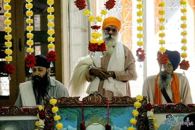
   5 km from Kasol, Manikaran Sahib, a famous Gurudwara lies on the bank of Parvati river and known for hot water spring, devotees take a dip in this hot water spring and offers prayer to the main shrine. The hot springs in some portion are hot enough to boil rice. The local claims that it is powerful enough that it can heal the diseases of the nasal tract like rheumatism and bronchitis. Langar is always available here. There are also temples of Hindu deities Rama, Krishna, and Vishnu.


Gurudwara Manikaran Sahib

Inside Manikaran Sahib


Naina Bhagwati Temple, Built fully with wood.


Chalal:    
  Chalal a nearby village, 20 min casual walk from kasol opposite to the Parvati river is a hub for psychedelic parties.   Music festivals are often held here and draw a lot of visitors. Many rave parties also being conducted here throughout the year.


Bridge to Chalal